Road closures to be aware of in WNC this weekend – not all of these are currently marked on navigation apps:
– Hwy 19E from Ingalls to Cranberry (Avery County) – Hwy 221 in Linville (Avery County) – Hwy 70 in Old Fort (McDowell County) – Hwy 9 in Black Mountain (Broad River) [Buncombe County?] – Hwy 74A/64 in Bat Creek (Henderson County?) – Hwy 176 in Tryon/Saluda Gorge (Polk County) – Tunnel Rd in Asheville (Buncombe County) – Cane Creek Rd in Fletcher (Henderson County)
Sometimes I see stuff that is straight up apocalyptic
and I go home thinking “How can this happen? What can be done?”
and then from doing research online, I find out that the situation was actually much worse weeks ago before I could even get there.
I hear from locals and they talk about how lucky they are to be alive. How their friends lost their homes and much of what they owned. How blessed we’ve been to have mostly clear, dry, warm weather since the storm, providing this chance to rebuild.
Some areas are just extremely dangerous to even access right now. Some places are opening back up for tourism. Some of the “open for business” towns are still seriously hurting. WNC alone is 200 miles long and 100 miles at its widest, a diverse collection of tiny but diverse communities in different climate zones and unique geographic features. There are 25 counties in WNC alone, and that’s not counting the affected areas in East TN, Southwestern VA, Northwestern GA, and Upstate SC. This means that each challenge is different, and there are hundreds of thousands of challenges in the wake of the storm – today, after more than six weeks of tackling challenges for a lot of us. Everyone is exhausted – emotionally, physically, mentally wore out.
I need to remind myself to be patient with folks who aren’t in this, who are watching from afar, just trying to figure out what the hell is going on in the mountains.
It’s been a rough ride for a lot of people. But sometimes we gotta appreciate just how much progress we’ve made, overcoming something so massive.
We are gonna get through this, and we will be alright.
For the first time in almost two months, I hear the owl outside my home again
Been a long time buddy, welcome home. Good morning!!!
At this point, I was in a state of constant exhaustion, especially after an overnight trip to the High Country making three supply runs to Minneapolis, NC. I felt like I had a cold or bad allergies, which do not have any apparent cause – but also, thankfully, do not appear to have been transmitted to anyone else.
I spent as much time this week sleeping as I could, to be honest. It still doesn’t feel like enough. And at the same time, it’s been maddening to be stuck at home, instead of back in the mountains.
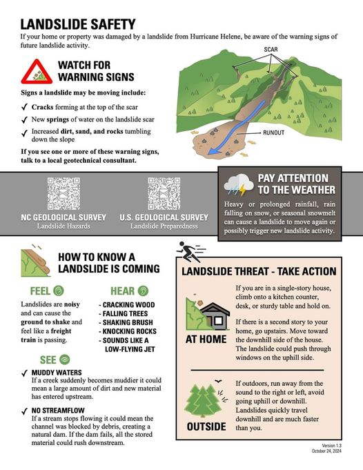
Bringing this back today with the rain moving through the area. Be on alert, especially in steeper terrain!!
Some road areas are patched up, but not 100% fixed yet – as they really just needed to stabilize them enough to let residents come and go, and so crews could move forward to the next damaged area.
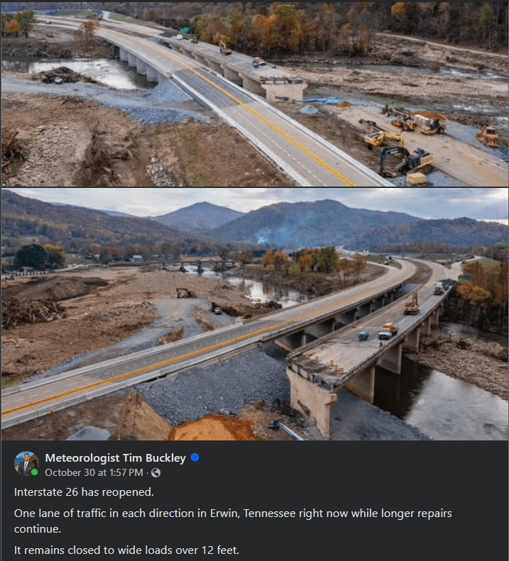
I-26 and I-40 are pretty good and secure in the areas that are opened back up, at least as far as to Asheville/Swannanoa; it’s the traffic you need to worry about on the interstates. I am more concerned about the smaller highways – especially in the Saluda Gorge, Hickory Nut Gorge, or going up into the High Country. You also might see some road washouts get worse, so don’t take any unnecessary risks!!
Sitting in a warm, dark, dimly lit coffee house, sipping a warm, foamy glass mug, listening to piano jazz, and looking out the window as the rain comes pouring down. Dripping down the windows into the gutters like piano keys.
It hasn’t rained like this since the days before the storm. I’m not talking about Helene herself; I’m talking about that slow, steady, windless downpour that continued on and off for days before the hurricane ever showed up. If you don’t know what I’m talking about by now, the locals will sure tell you. It’s the one consistent theme in every story I’ve heard, the one key detail everyone wants to make sure you remember: the rain didn’t start with Helene.
Today is not like seven Thursdays ago. The rain isn’t pouring off the ground in sheets this time. I didn’t listen to trees breaking around me in the middle of the night, and I didn’t wake up to the sound of the river roaring next to me. And that river is running high today, but it won’t flood the banks. Not this time. Sometimes, I find, it helps to remind yourself both where and WHEN you are, when your mind starts to slip back into survival mode from emergencies long past.
I’ll be thankful not to see the mud lines anymore. The researchers have had seven weeks to study how high the floodwaters rose – let us clear away the toxic dust and give us all a chance to breathe a little more easily now.
But today is a day that drives the urgent necessity of warm shelter for so many across the mountains. We have been absolutely blessed by the weather so far, remaining relatively warm and dry ever since the hurricane. Unfortunately, WNC – especially Buncombe County – was facing a severe housing and homelessness crisis long before the storm. Tent camping, and asking for help on the street, is technically illegal in some areas – and I suspect outside volunteers are not highly aware of this. It is time to finally tackle a topic that was deferred for far too long. It is also time for Upstate South Carolina to face our own homelessness and rental crisis as well. None of us likes to think about how we might be just one unlucky day away from losing it all. I want to see us, as a society, come together for ALL of our folks in need – not just at times like this, when the crisis is dramatic and is more than we can handle.
Like a suspended chord that leads into the relative major, and ends the song on a lighter note. We can transform a rainy day into a brighter future. I believe in this.
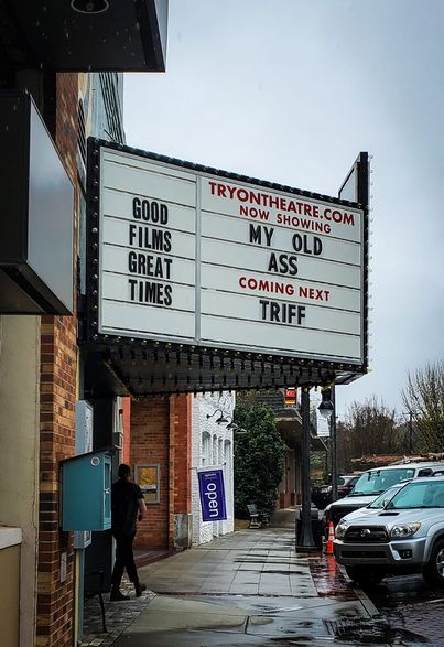
If ya’ll could have been there the moment I pulled into downtown Tryon and the very first thing I see is the Tryon Theatre marquis, “NOW SHOWING: MY OLD ASS”
P.S. this little town is looking beautiful and is wide open for business
The rain came in like a blessing. A gentle hand to wipe a little mud away. It’s been four weeks with no rain here in Spartanburg. Believe it or not, we needed this.
Mill Spring is recovering, and also providing a lot of support to their neighbors around Lake Lure. I know a lot of good people out that way. You can tell from driving through that they took a lot of damage – both flooding and wind. The chainsaws have been as hard at work in this area as they were in Spartanburg County, and I still hold the theory that the vortex bore north and slightly west from here through the mountains. The sign for the pick-your-own vegetable stand is still up, although the tent was torn up, and I’m not actually sure if it’s operating or not. There are areas on Highway 9, around the Green River and Little White Oak Creek, where I kept the windows rolled up from the flood mud. (I’ve seen it really bad on Highway 11 and Coxe Road as well.) It’s really heartening to see the horses, cattle, goats, back out in the pastures.
The Dark Corner is famous for breeding some of the finest horses in the world. Believe it or not, I have a little experience with taking care of horses (and mucking out stables lol), back when I was a kid in North Carolina. I’m not claiming to be a seasoned rider or anything; it’s been many years since I was on the back of a horse. Just saying, they’re pretty cool animals – and sensitive creatures with a lot of needs, very difficult to keep and raise in captivity.
There are hollers around Polk and Spartanburg Counties. You find then around Clifton, Glendale, New Prospect, Campobello, Mill Spring, Green Creek, Green Hill. These are NOT tourist towns – they’re mainly farming communities in the foothills, with houses, trailers, cabins, shacks, sometimes nestled along dirt roads in the low spaces between ancient hills that are only a couple hundred feet high. Thank goodness they all seem to be getting back on their feet – from what I’ve seen anyway – but you do still see the scars everywhere you look. Clifton and Glendale in particular looked like they were in rough shape, and they are not a particularly wealthy area. There is SO much roadside debris to still be cleared, all over the place. We need to find a way to store the usable lumber and, uh, use it. That’s tons and tons of healthy pine and oak wood that snapped, and shouldn’t all go to waste.
I’m also really concerned about the orchards in Cherokee and Spartanburg Counties. They took on massive flooding from the Broad and Pacolet Rivers, as well as extensive and intense wind damage. These same farms have already struggled this past season, when flooding earlier in the year took out strawberry crops; the year before, a late frost zapped the peach harvest, forcing some farmers to source peaches from Georgia just to have something to sell in the roadside markets. Those markets support a lot of local farmers who are going to need a lot of busines – they’ve kept us fed for generations, and if we lose those farms, they will be bought up by corporations to put subdivisions, or those giant gray concrete monstrosities on instead.
So I guess what I’m saying is…
Come out to the mountains and the foothills.
Come to a town that’s open for business.
Come fill up at a roadside farmer’s stand, or visit a local farmer’s market. It’s healthier anyway, I promise you.
If the local community hubs can’t take your donations, you might find someone on the side of the road who needs then.
There’s a whole lot of good happening right now in the mountains, and we should all be a part of it.
One month later, I finally hear the train running again. I’ve always said it sounds like it’s singing through the trees. It’s a haunting pitch, but comforting in its own way. I know this song well.
I wish I could hear the owls again. A few days after the storm, I heard one calling… and I didn’t hear the other respond. I haven’t heard either one since that night. I hope their chicks will come back here to roost one day.
I guess this is what recovery sounds like.
The sounds you once knew and the sounds that you won’t hear anymore. One instrument picks up the refrain while the other takes its rest.
I just don’t want to wake up and hear the river from my bed again. I prefer the creek’s quiet hum and gentle rhythms.
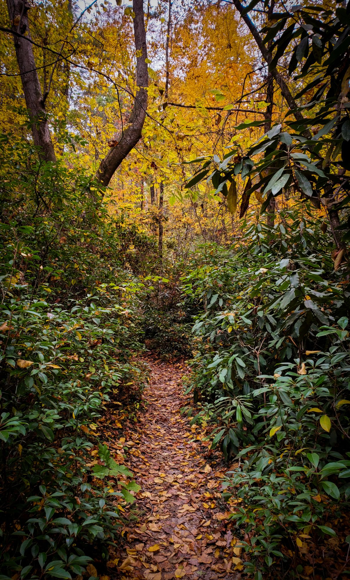
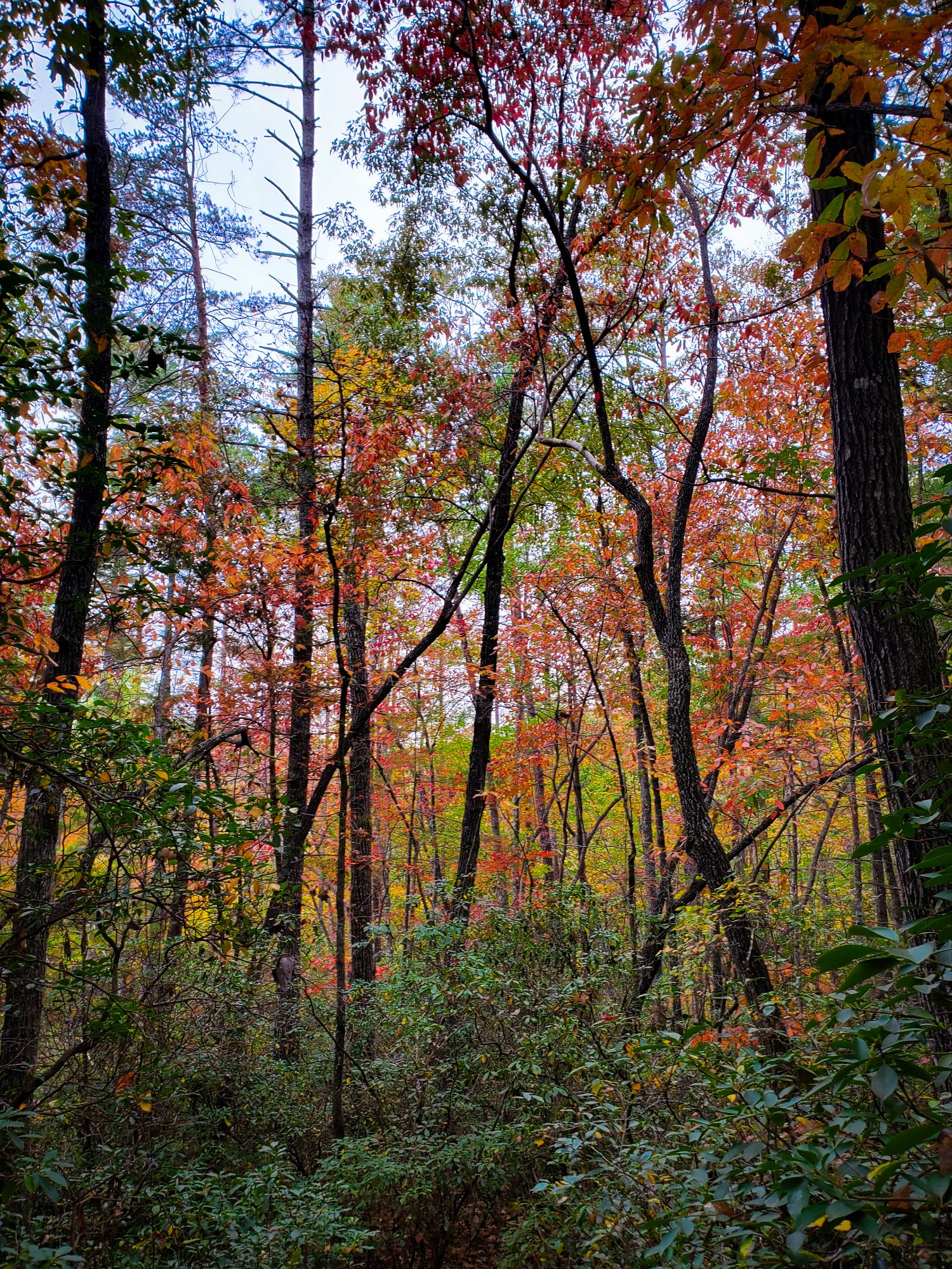
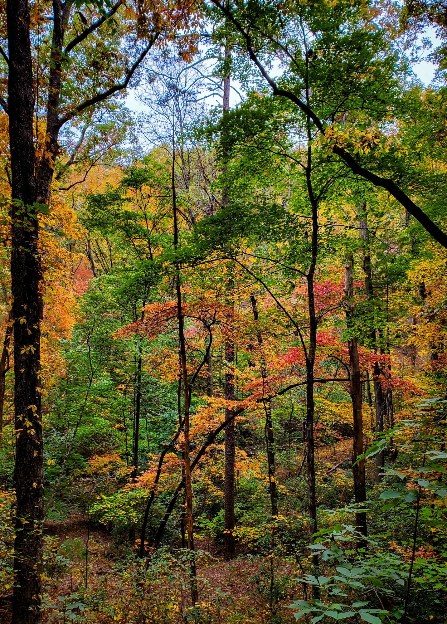
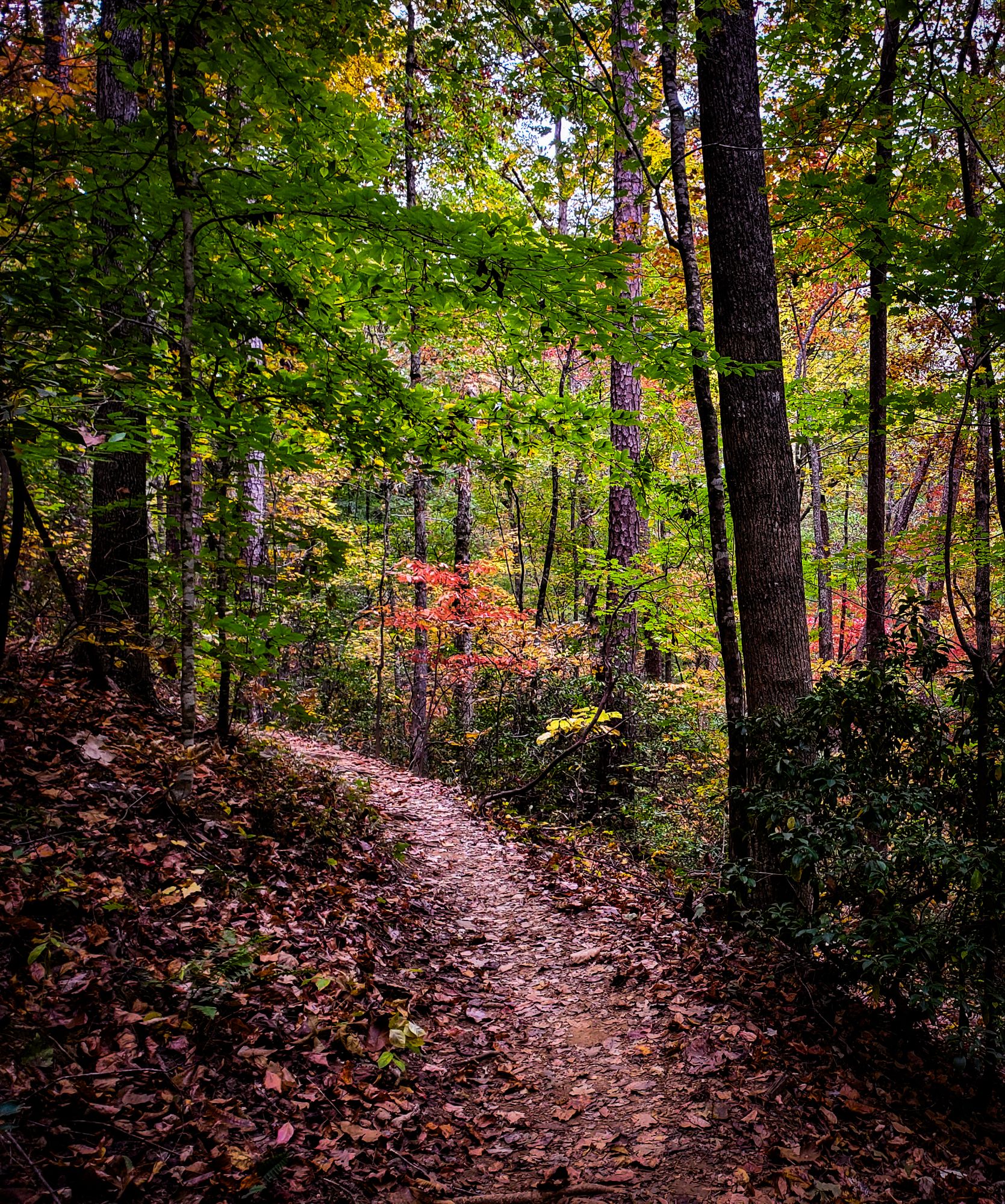
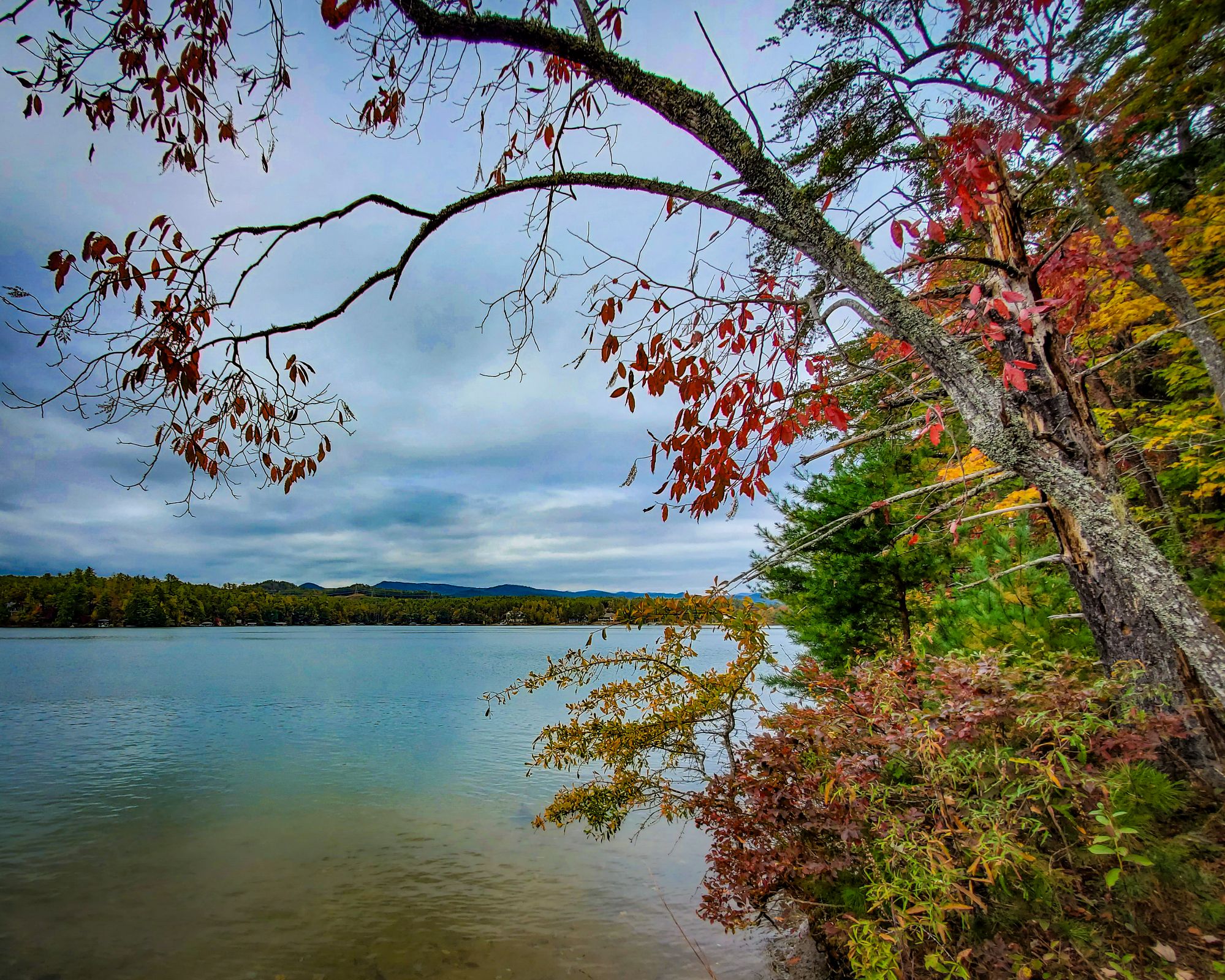
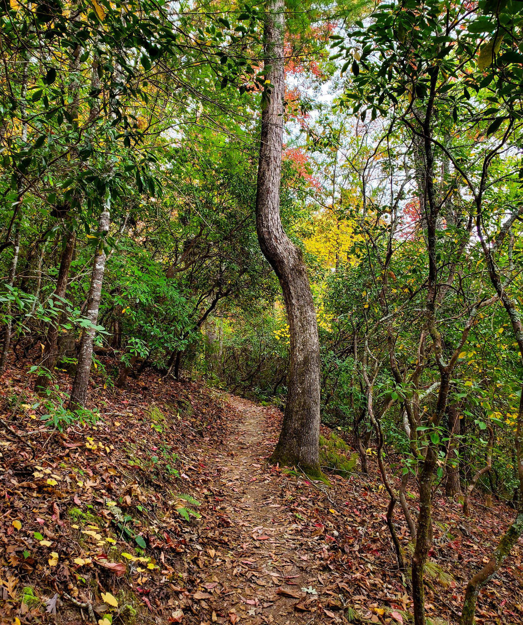
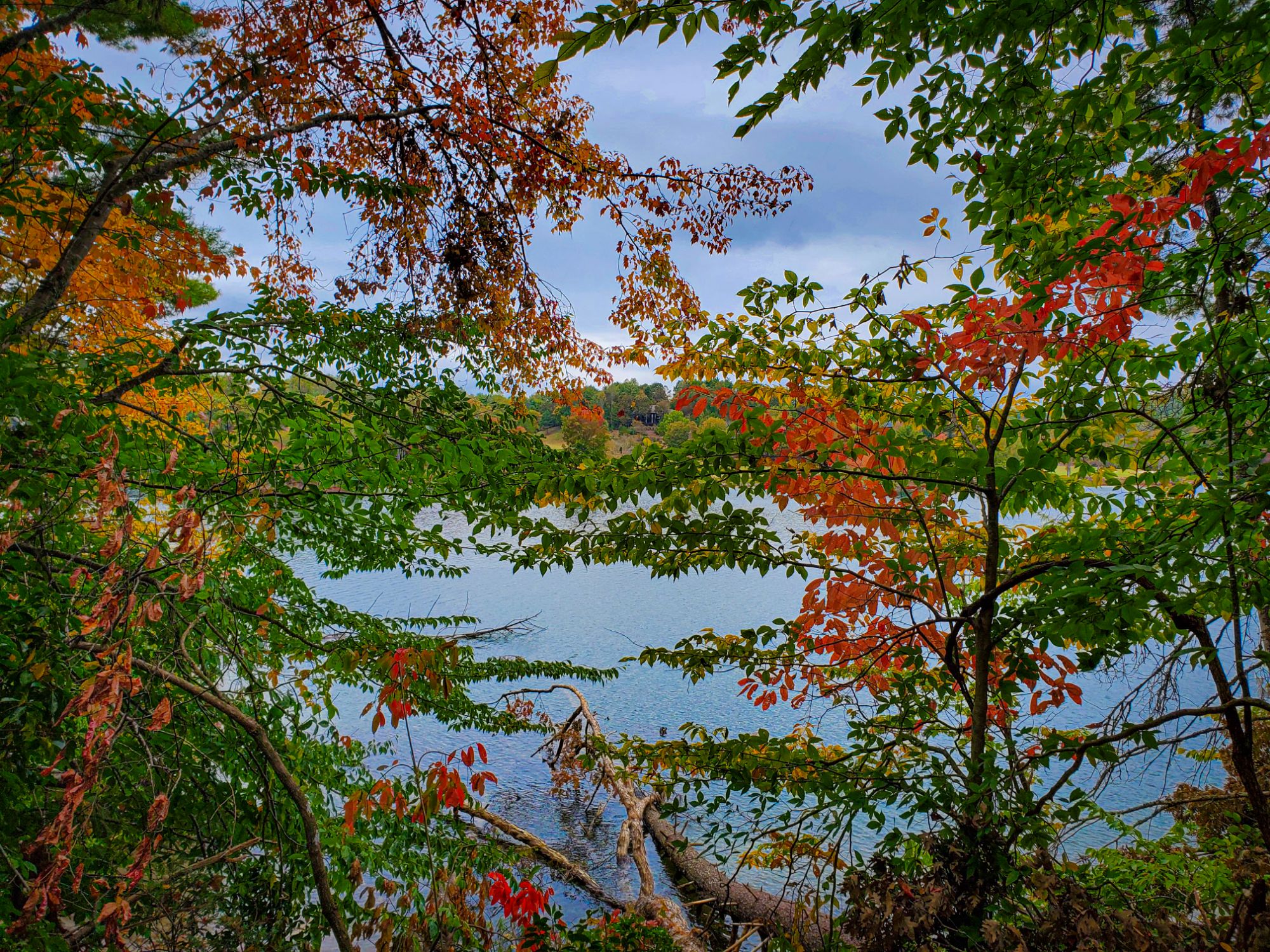
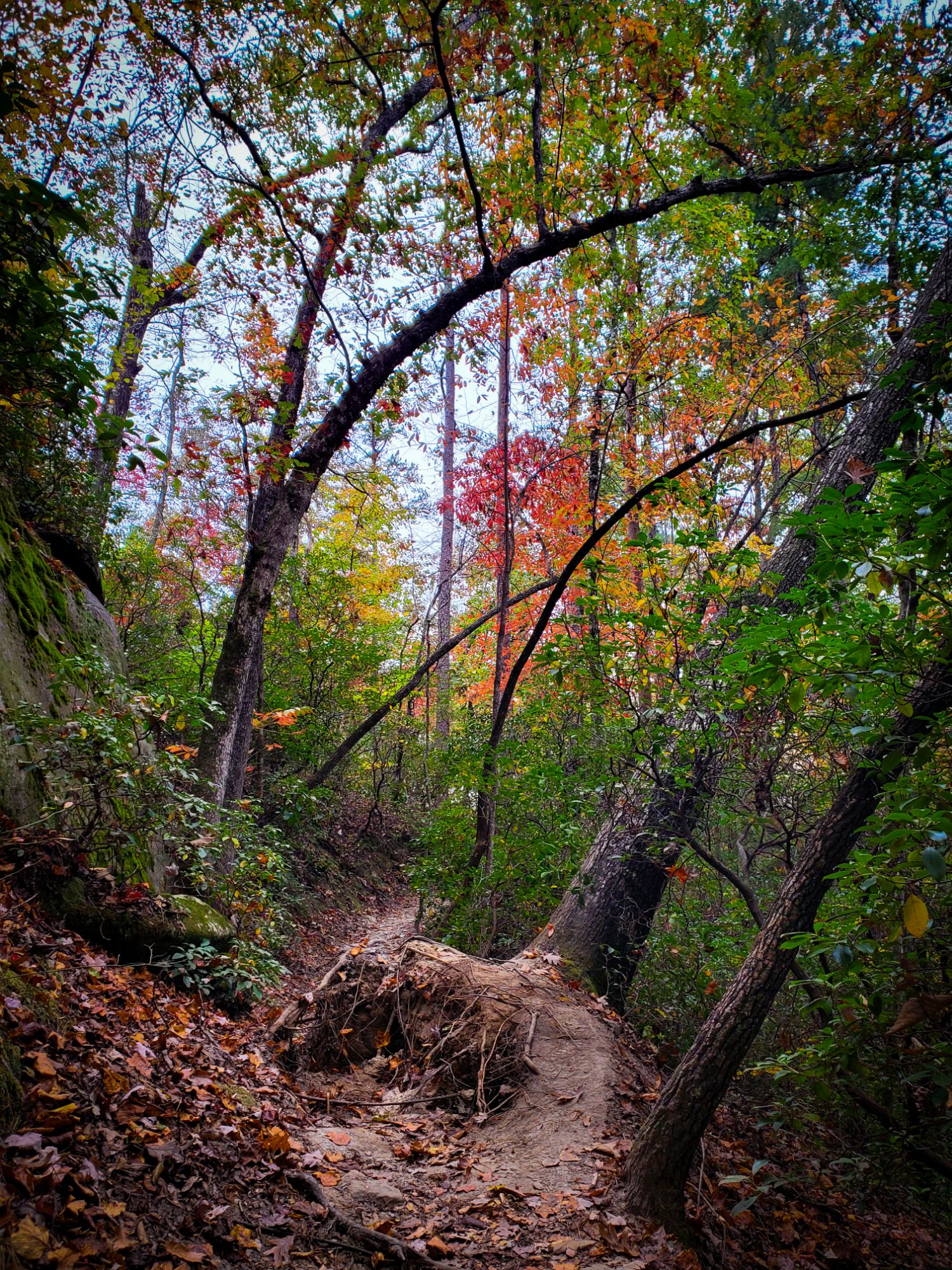
You want to visit the mountains? You want to see beautiful fall colors? You want to support folks who need it without putting yourself in traumatic situations? You wanna just take a regular vacation, darn it?
Highway 11. That’s where you go.
You take I-85 right up to the giant peach. Yes that giant peach. You stop at Abbott Farms Produce and get you some of their apple bread. I mean it.
You just take that highway, skip through I-85 nonsense, and ride baby ride through the most picturesque autumn mountain scenery with the least amount of traffic. Chesnee is a great little town to stop for gas and food. They got hit REAL hard by Helene, and that town is full of a bunch of great people – a lot of the best folks I’ve known have lived in Chesnee. There’s an archery shop, a tattoo parlor, an herbalist, and a coffee truck all right next to each other. Bantam Chef Restutant is a local favorite.
Then you will drive past Strawberry Hill USA Farm, which is quite literally the most picturesque farmland I’ve ever seen in my life. Rolling green hills, rusted tractors nestled along aging barns, more American flags than you can shake a p*litician at. You can watch it all from rocking chairs on the front porch of their general store/ice cream shop.
After you pass through Campobello, you gotta stop at Peach Country Roadside Market where Highway 11 meets the very very end of New Cut Road, because the view of the Blue Ridge Mountains from there is perfect. Then you turn around and hope you’re lucky enough to pick up one of those ice cream pies from that nice Amish lady who writes “God loves you” on all of them.
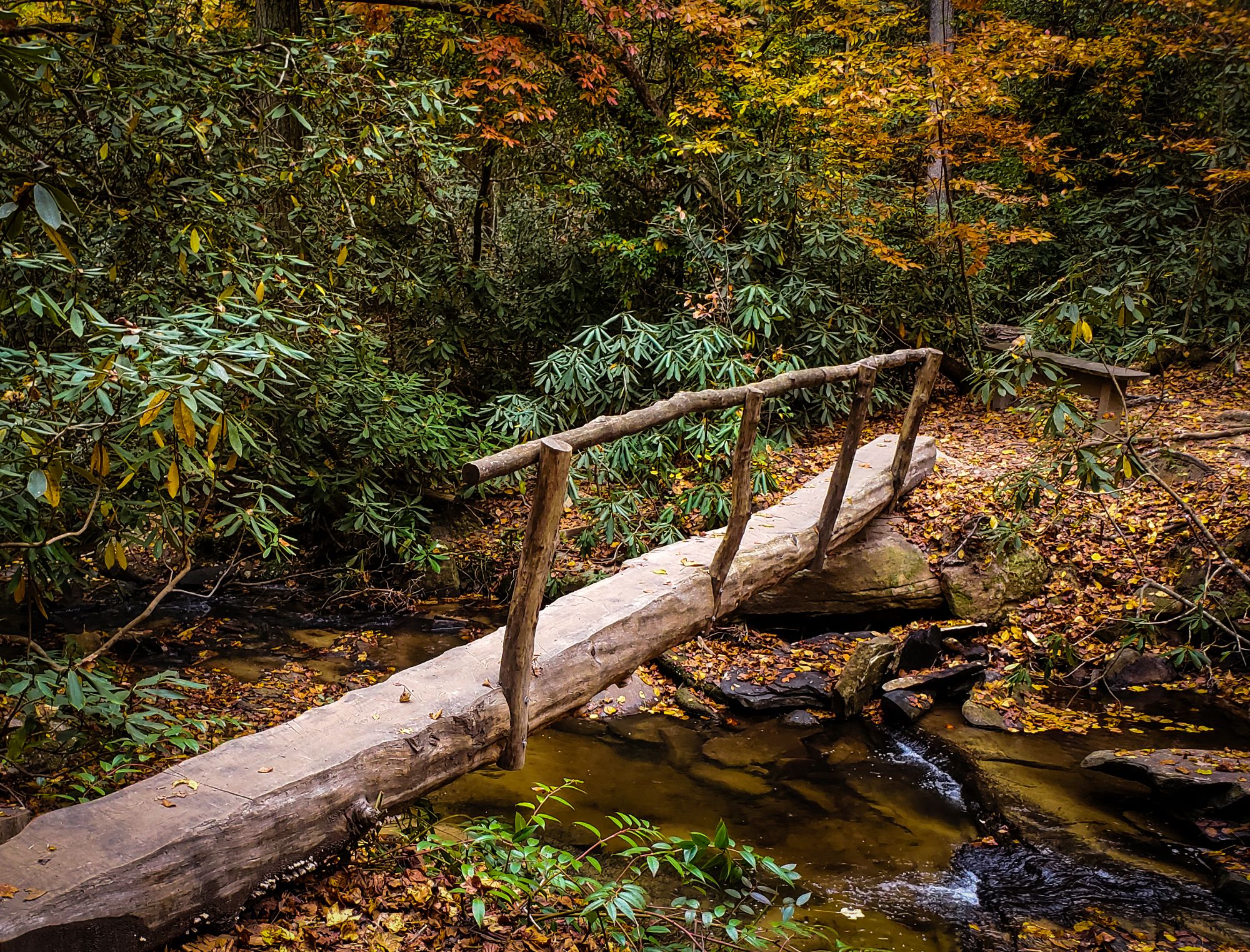
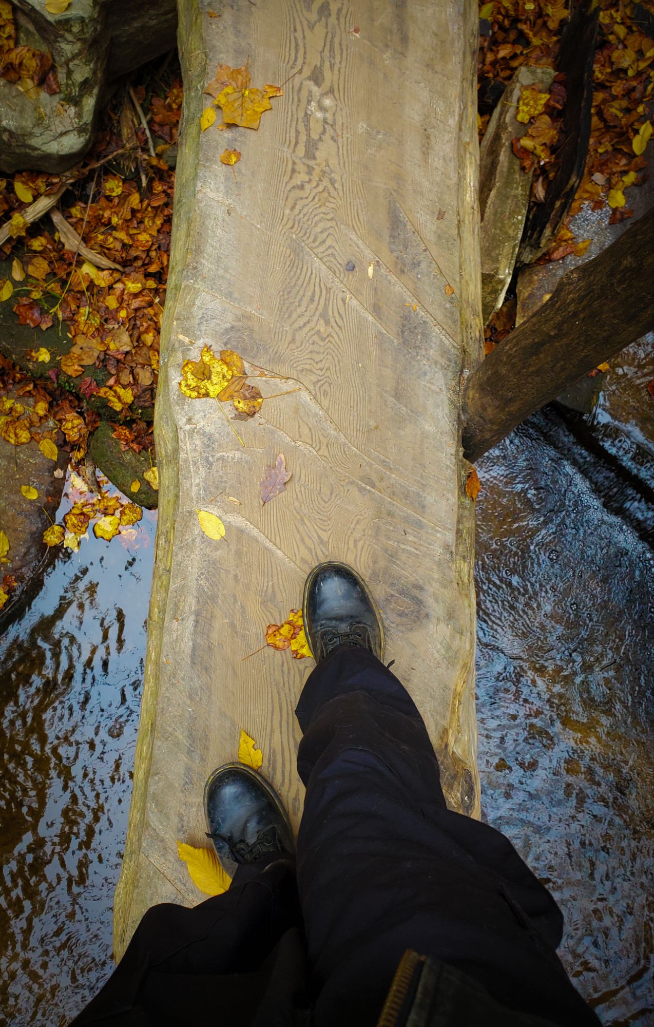
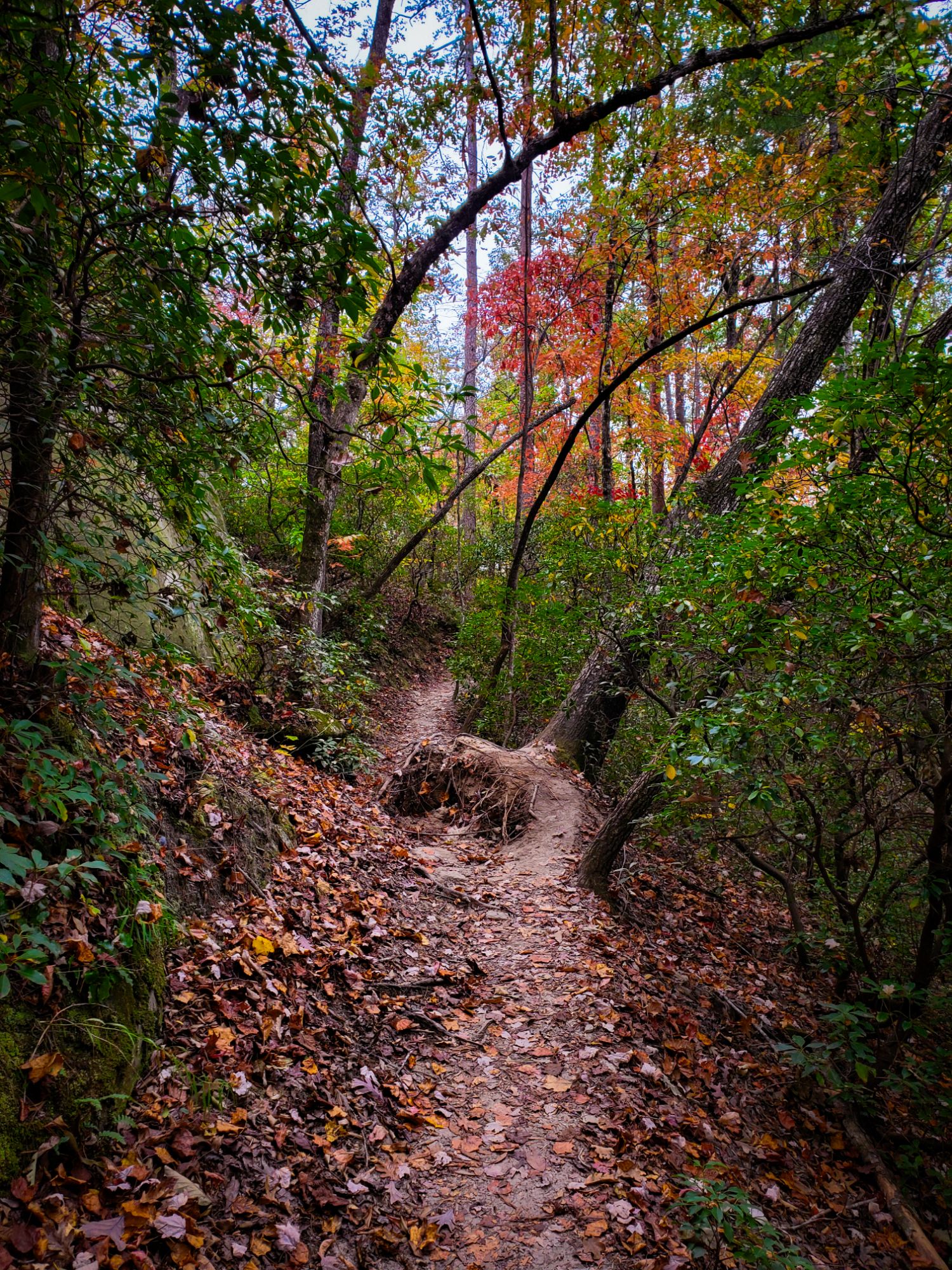
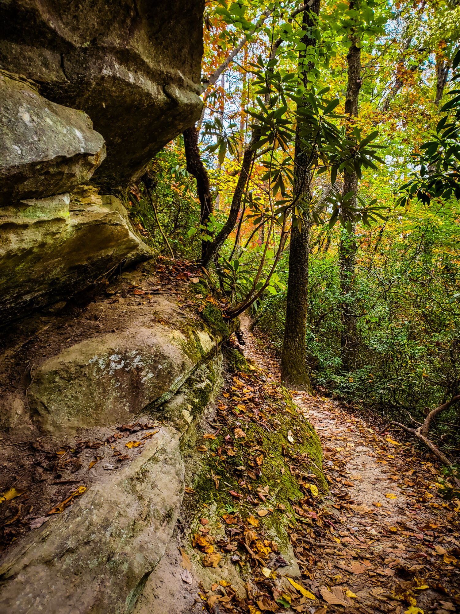
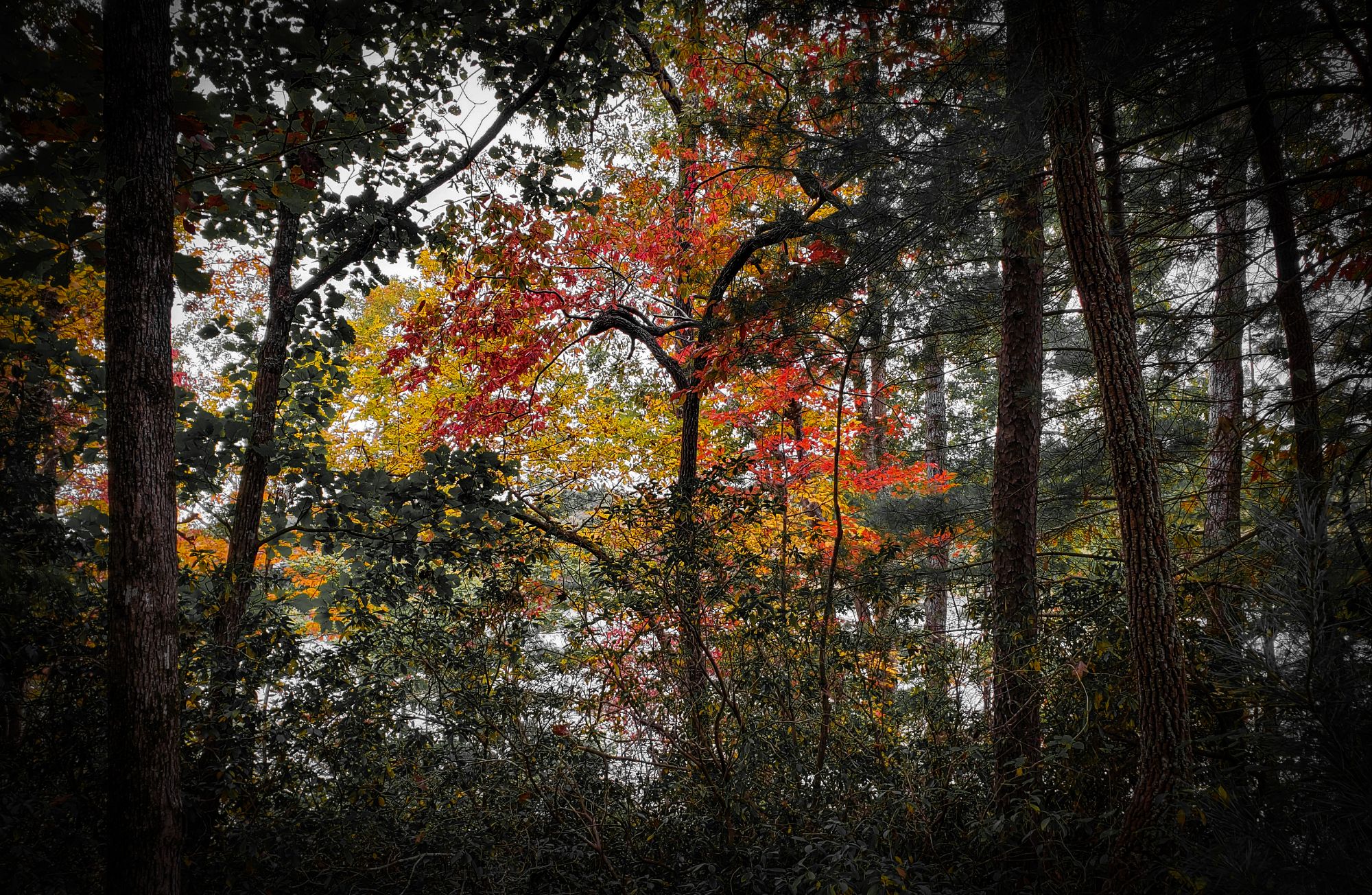
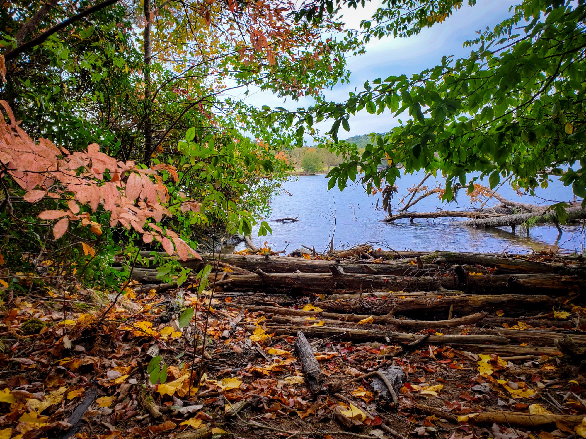
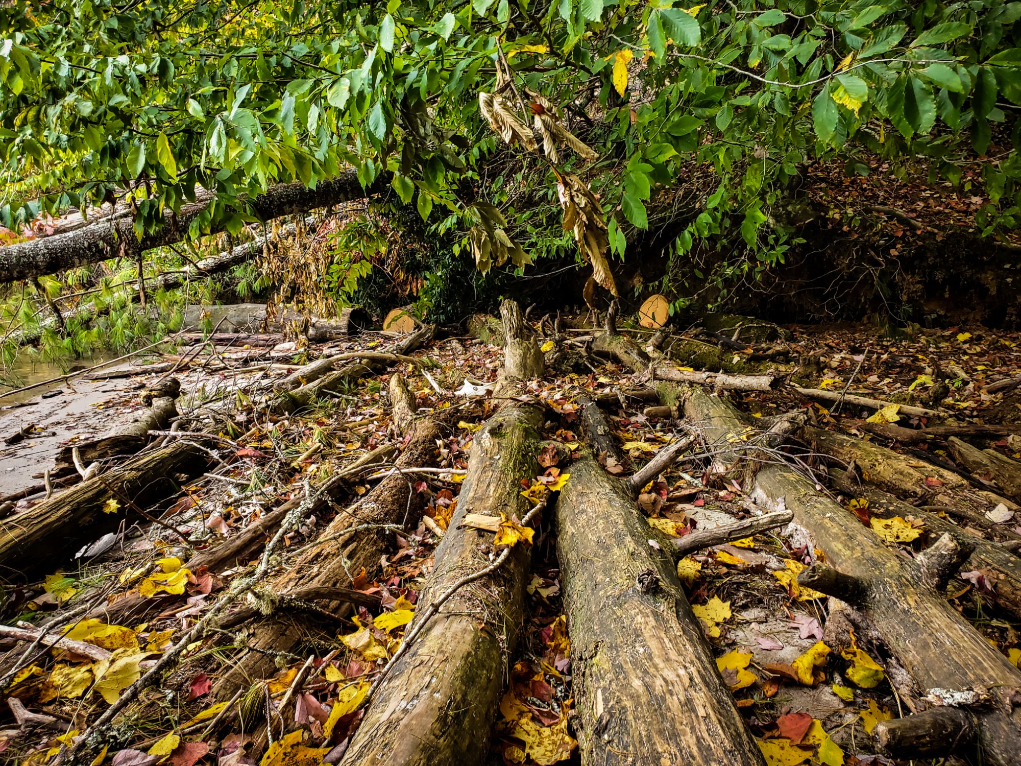
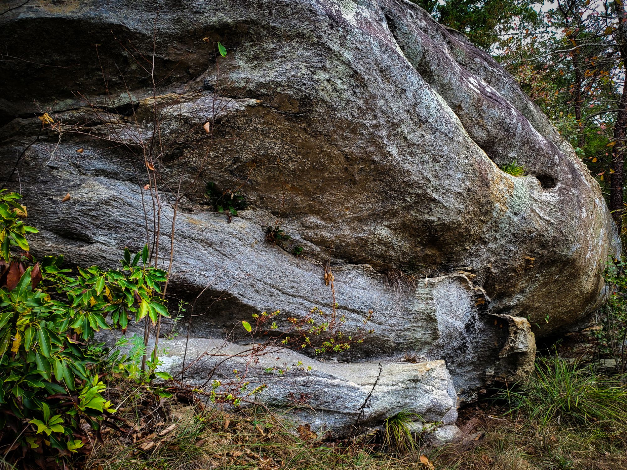
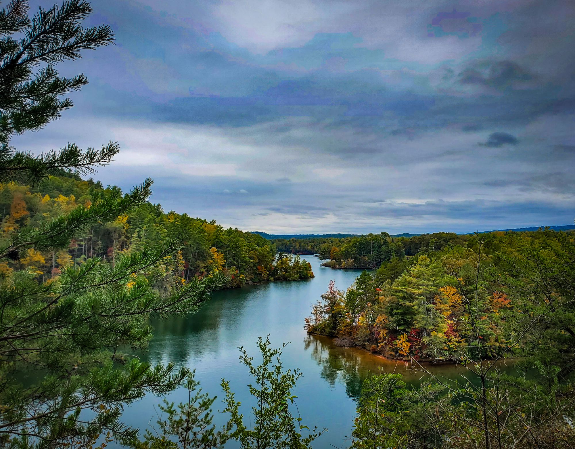
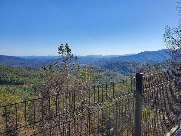
You’ll wanna drive safe and careful through Cleveland (yes, this is a small mountain town in SC), on your way to a magical place called Pumpkintown. The trees are just as orange as the town’s namesake right now. Pumpkintown Mountain Opry is the coolest building in South Carolina, with a fascinating history, AND really good pumpkin spice lattes. Aunt Sue’s Country Corner is a cozy marketplace full of local artisan goods. Also, consider pulling over to enjoy the view of Table Rock for a few minutes at Grant Meadow Overlook, like I did in these photos.
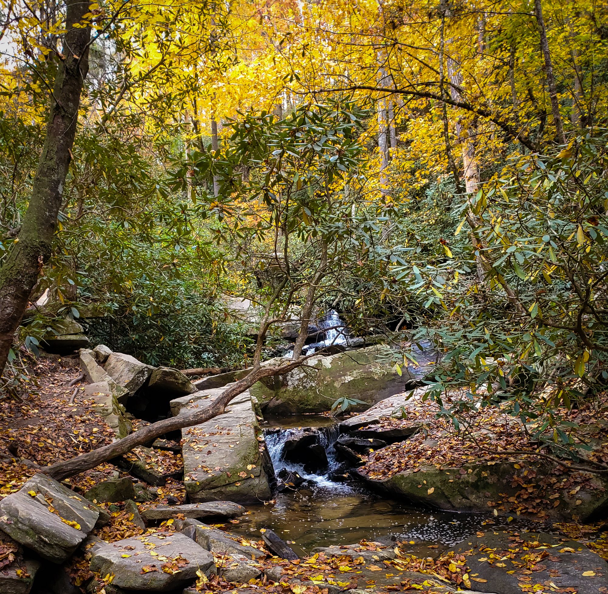
The photos that will come next are of a place so beautiful, I won’t even tell you where it is.
I have shown you destruction because that was the reality. Now I’m going to show you miracles – those of nature and those of man – because that’s the reality right now, too.
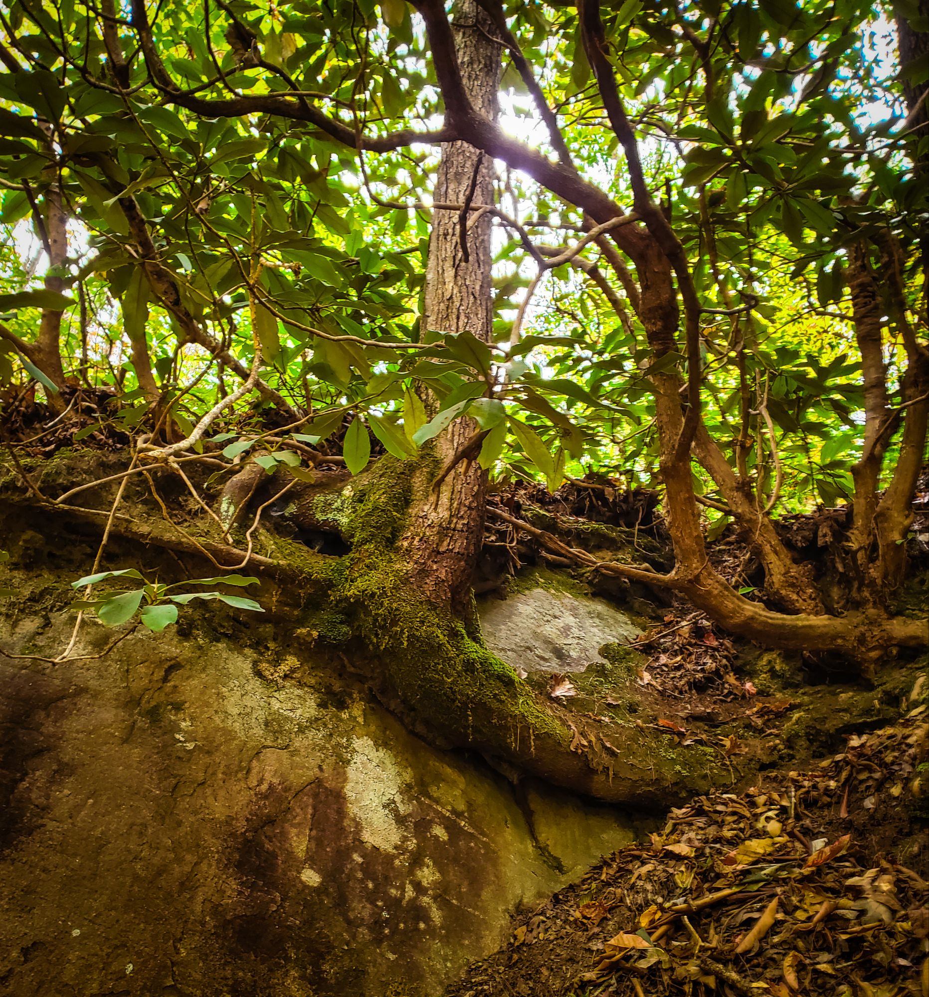
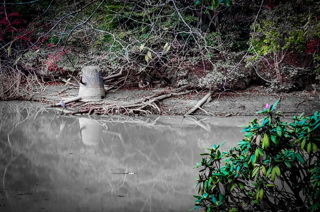
I passed by a thousand rhododendron bushes yesterday, in mountains that weren’t hit nearly as hard as the Hickory Nut Gorge. But without a doubt, the only flower I’ve seen on any of them… has been this one in Lake Lure. 30 days after the flooding began.
Yes, I do believe in miracles.
Pick yourself up and carry on. You are going to get through this, and you are going to be okay.
“The glittering leaves of the rhododendrons Balance and vibrate in the cool air; While in the sky above them White clouds chase each other.” –John Gould Fletcher
This is the best explanation anyone has provided so far of what happened that day.
Ashevillewx-Meteorologist Hunter Ward 10/27/24
Helene and What Happened in WNC? It has taken me some time to reflect on this life changing event. What didn’t really seem possible on models leading up to the storm, came to fruition. Each run winds got higher and rainfall totals increased. For 3 days leading up to this storm I had near sleepless nights. Why? Because this storm just felt different. On Wednesday an Upper Level Low moved into place over Tennessee and it began to interact with a moisture push that was far out in front of Hurricane Helene. By late Wednesday evening many areas had already received over 5” of rainfall with some areas seeing 10”+ of rain from the initial push of moisture. Along the Blue Ridge Escarpment the rainfall was just wrung out of the atmosphere and excessive rates fell in locations like Lake Lure & Bat Cave, NC. We could have easily survived this inital punch with little repercussions here in WNC. The mountains shed that initial push relatively well and if the rain had stopped life would have quickly returned to normal. As we know, that wasn’t the case. With the Upper Level Low still in place on Thursday evening over TN as Helene made landfall it rotated toward the Upper Level Low by way of the Fujiwhara Effect. This is important because this large scale effect in the atmosphere kept Helene from recurving and slammed it right into WNC. As we progressed to Friday morning soggy soil awaited 50mph+ winds and another 3”-10” of rainfall. As stated in many of my posts before the storm, this was a recipe for a natural disaster. The right front quadrant of a Hurricane is always the strongest part of the storm. You can vividly see the trail that the right front quadrant took by just looking at the wind damage maps. From Bat Cave to far North Yancey Co. the wind damage to the trees is just astonishing. A 20-30 mile path of just an absolute desecration of trees. Now other areas got high winds and tree damage, but this 20-30 mile area got the worst of it due to the right front quadrant. Winds gusted over 100mph at Mt. Mitchell and you can clearly see around Black Mountain, Swannanoa ect where those mountains have been scalped (photo below). The trees are just gone or all pushed over. What happened next changed the entire landscape of WNC. As those trees fell, the soil around them that was already extremely loose, let go of the mountain. With that soil now moving it was similar to a domino effect. Those trees and soil hit other trees knocking them down and gravity brought those flows down the path of least resistance. Unearthing boulders, these flows eroded everything in their path and when they arrived at the main channels they began to create dams. Remember that rainfall rates increased significantly as those highest winds gusts moved through WNC and then persisted for 2-3 hours after. As those rainfall rates increased, the mud/debris/boulder slides continued and enhanced. So you have debris flows coming from many locations where water barely flows and then those debris flows moved into the main channels (French Broad River, Swannanoa River, Pigeon River, Cane River and several others). As the water rose, so did the debris content in the water. Whole trees from higher up on the mountains made their way into the valleys below. Water leaves the mountains very quickly and all that mud, boulders, and debris begin to exit at an incredibly pace. Water rose to record levels along many creek and river basins moving into many businesses and homes that had never seen water inside before. As the water rose many structures began to be struck by debris as well. That created extra resistance in the water flow and put extreme force on many structures foundations. We saw countless foundations fail due to debris and water inundation. As those foundations failed, the structures became in a crude way, a boat. As these structures met rapids the river turned into a blender. At each overpass structures were mangled and dunked into the river. By 11am on Friday, most of the rivers were closing in on peak flow. By 3pm the sun was coming out in many locations. Without communication, no one knew how bad things were. There were many locations that only had power outages and downed trees. People in WNC knew flooding was happening but unless you were witnessing the rivers it was hard to fathom what was happening all around. So, after about noon on Friday the people of WNC went to work. We started checking on our neighbors and getting a plan of action. We all eventually remembered radios and we turned it on to 570WWNC. Listening for mere moments and all of your senses were heightened. Swannanoa is gone? Chimney Rock gone? Garren Creek? The water system is destroyed? Over a million without power? Thousands missing? WTF just happened. I was predicting a life altering storm, but I don’t think I could have imagined what was about to occur. As we came to this realization that life would never be the same, WNC didn’t hide, we jumped into action. In hindsight, I wish I would have pulled up google earth to reiterate vulnerable neighborhoods. As meteorologists we will continue to work to get the message out and learn from each event. This community that I grew up in and have called home for 35 years continues to amaze me. I love you so much WNC.
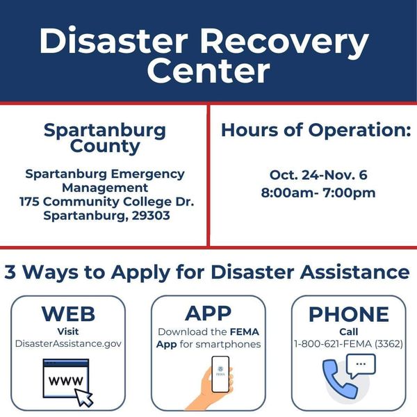
THIS IS A MESSAGE FROM SPARTANBURG COUNTY EMERGENCY SERVICES REGARDING IMPORTANT HELENE UPDATES
– FEMA Disaster Recovery Center is here until November 6th / 8am-7pm / 175 Community College Dr Spartanburg
– Have Debris that you cannot afford to cut and/or remove? – Call Crisis Cleanup Hotline at 844-965-1386 – Deadline to call is November 1st – Once again, that number is 844-965-1386
– Can’t attend the DRC in-person, call FEMA at 800-621-3362
– Storm-related vehicle damage? FEMA may be able to provide financial assistance to help fill the gap – Find out more by coming to the DRC at 175 Community College Dr Spartanburg, or going online at disasterassistance.gov, or calling 1-800-621-3362
Messages from friends asking how you’ve been, reminders to stay in touch…
A big hug from someone you didn’t hear from until days after the storm passed…
Pregnancy photos in the fall mountain colors from a friend bringing new life back into the world…
Last minute road trips to Asheville for a night out with friends at an open and inviting business…
And honestly, that drive up I-26 at night, you can pretend nothing happened a month ago. You can forget for a little while. It all looks the same as you travel back down into the Dark Corner with only headlights to guide your way.
You can’t actually forget. The entire world has been shifted here, unmistakably, irreversibly. There is a before and an after, and there always will be. Yet even after everything, it still feels like the mountains are helping me more than anything I can give back.
Appalachia will endure.
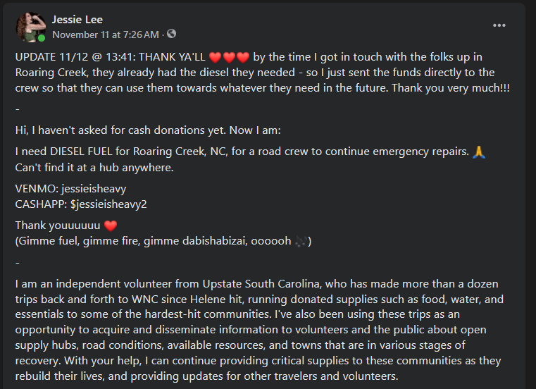
My very awesome friends and followers donated some funds to help this crew get some additional fuel and supplies:
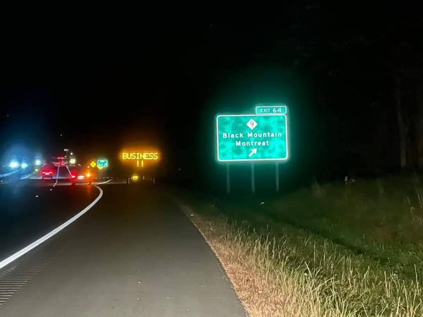
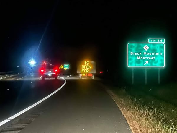
Black Mountain, NC is OPEN FOR BUSINESS Old Fort, NC is OPEN FOR BUSINESS Marion, NC is OPEN FOR BUSINESS Hendersonville, NC is OPEN FOR BUSINESS Asheville, NC is OPEN FOR BUSINESS Mill Spring, NC is OPEN FOR BUSINESS Saluda, NC is OPEN FOR BUSINESS Tryon, NC is OPEN FOR BUSINESS Rutherfordton, NC is OPEN FOR BUSINESS Landrum, SC is OPEN FOR BUSINESS Chesnee, SC is OPEN FOR BUSINESS Gowensville, SC is OPEN FOR BUSINESS Pumpkintown, SC is OPEN FOR BUSINESS
EDIT 11/4: it’s been 3 days now, and some of this information has changed or been specified by the hubs themselves. Communicate with the hubs themselves/check their official channels for updates on what they need today! Thank you to everyone who has been sharing.
–
Saluda hub: Green River Adventures distributing supplies at 150 East Main St, Saluda, NC 28773
Swannanoa hub:Restoration Church of God needs BUILDING MATERIALS AND BUILDERS at 90 Buckeye Access Rd, Swannanoa, NC 28778 (UPDATE 11/4: Mary Beth Poole has been providing regular updates foe this hub)
Black Mountain hub:Silverados needs HELP WITH ORGANIZATION AND DISTRIBUTING 2898 Highway 70, Black Mountain, NC 28711 (UPDATE 11/4: find full updated list at Valley Strong Disaster Relief)
Old Fort hub: The Davis Country Store & Cafe needs HEATERS, GENERATORS, CAMPING STOVES AND BUTANE 75 East Main St, Old Fort, NC 28762 (UPDATE 11/4: find full updated list on their page, specifies what kind of gear and fuel they need)
Spruce Pine:Project Skyline needs GENERATORS, HEATERS & FUEL at 12255 Highway 226A, Spruce Pine, NC 28777 (UPDATE 11/4: find full updated list on their page)
There are a lot more needs than this.
There are a lot more hubs than thus.
I’m just keeping it simple here.
Let me know if any updates or corrections are needed.
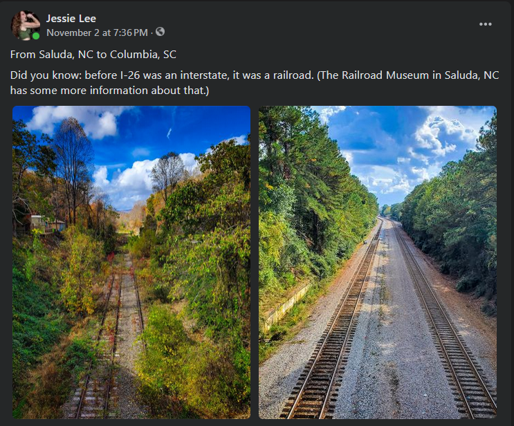
The town of Saluda, NC is named for the mountains in which it sits – where the Saluda Grade Railroad once crested, picking up and dropping off passengers multiple times a day between Spartanburg and Asheville.
Much like Tryon a few miles down the mountains, the town is now better known for its cute, colorful downtown shops and restaurants, and the sprawling horse farms located outside of town. Here, you can pickup homemade soaps, lotions, honeys, baskets of farm-fresh produce, bottles of fruit cider and home decorations. You could finish your holiday shopping by this afternoon without spending a moment at the mall. (Tell your wife!)
Cheerful flowers poke out of pots along the sidewalk. Ice cream parlors and general stores beckon with doors wide like open arms. Mewdlic’s made me a real good cup of coffee, and hosts jam nights on Wednesdays and Fridays – musicians are welcome to stop in!
There is art! There is history! There is beauty!
But – stay on the safe roads! Scroll further through these photos to see what you might be driving on if you leave the main highway (176). The highway is CLOSED between Saluda and Tryon, so you’ll want to come in via I-26.
P.S. If you have a bicycle, or heck if you want one, please go support Adventure Cycles NC on the edge of town, and tell him Jessie says hi!
There are towns that need help desperately. There are towns that are opening back up for business. And the line between these is way more blurred and indistinct than they should be – but that’s just how it is right now.
In the long term, in order to save towns and homes, we also need to save jobs and livelihoods. We need to save farms, family-owned businesses, downtowns, country roadside shops.
Just like it’s possible for a place to be beautiful and hurt at the same time…
Just like it’s possible to love what you’re doing, and still appreciate the gravity of what has been lost – and survived…
Just like it’s possible to cry out in despair, and to carry on with your head held high…
It’s possible to support Appalachia’s immediate needs, and its long term economy at the same time. Safely AND respectfully.
Drive safe Thank you for being here, and thank you for helping us rebuild so much land, and save so many people when time was critical. Thank you for all the donations. The battle is won, and God is good. Now comes the winter.
Appalachia WILL endure. And it will take all of us.
When Facebook identified my account as having “the potential to reach a lot of people” (look Ma, I made it?) it was the beginning of a massive headache – not the additional security. I started to have my posts censored, no longer able to post links, post in groups, or even comment on posts for a while. The “two days” restrictions ended up lasting nearly two weeks – and I was never shown what post(s) or comment(s) allegedly violated Facebook’s terms of services, either.
These are FREE apps I recommend to folks on the ground in the western Carolinas and eastern Tennessee:
– WLOS ABC 13 – local news for the WNC region. – MyRadar Weather Radar – localized weather notifications, pull up a radar quickly. – Police Scanner Radio – this also includes frequencies being used by amateurs for coordinating volunteer efforts. I’m currently listening to the American Red Cross in Rutherford County discuss efforts to bring wifi up for residents and Billy Graham Rapid Response Team Chaplains distributing supplies in Burnsville. – Offline Survival Guide – what it sounds like. – AllTrails – popular with hikers and bikers, still being updated with current reviews about physical conditions on trails in the affected areas. – Trailforks – similar as above, but you can download a map for offline reference. – onX Hunt – property lines, elevations, really helpful geographical data in general. (PS deer are running out in front of traffic like crazy right now. Be careful.) – ReGrid – similar but less offroad-focused and more property ownership focused, using satellite imagery. – RV LIFE Trip Wizard – locate RV parks – PictureThis – identify plants and fungi you may come in contact with. (Remember, southern Appalachia is one of the most ecologically diverse regions in the world.) – Life360 – share your live location via GPS with a trusted person. – Google Maps – obviously. But seriously, this is your best bet for staying updated on road closures.
I saw people in this Appalachian Americans group talking about holding off heaters and sending chewing tobacco instead to distribution sites, and using their experiences in Florida to criticize the response in the mountains, and I have well and truly lost my patience this morning. Lord forgive me but you ain’t gonna tell me from social media that DIP is more important than HEATERS right now.
ETA some are now claiming these photos are AI. The ignorance is incredible.
If you attended the benefit show at Tommy’s Pub the other night with Queen City Rejects, The Body Bags, and October, this is what your money went to we got a lot of cold weather clothing for young’uns, some toiletries, some work gloves, some bulk chips and drinks. These and the donations were taken to Spruce Pine today.
I-26 is clear up to Mars Hill – I passed by some army convoys headed that way as well. From there, Hwy 19 is a straight shot to Spruce Pine, but the road itself is gonna struggle with heavy vehicle traffic and I recommend keeping to the inside lanes, especially heading east. Hwy 226 IS NOT CLEAR PAST SPRUCE PINE QUIT DRIVING PAST ROADBLOCKS. I saw multiple out-of-state personal vehicles coming down past the roadblock, and the road even as far as I could get was NOT in good shape. Too many visitors are gonna end up causing highways to be re-closed and that’s not going to be a good thing for the folks who live there.
As for everything I saw today… that’s gonna come tomorrow. I stopped through Asheville on my way home. I walked through the River Arts District. I am honestly weighing whether or not to even share those photos.
Ya’ll be safe and THANK YOU keep supporting Appalachia!!! There is so much good being done all over, and we are going to keep that going no matter what.
**Please let me know if you were involved in the event and need an uncensored copy of the receipt!!**
Spruce Pine North Carolina for SAFE Camp operations was absolutely spot on.
We chose our location in Little Switzerland, and landed our base through a mutual connection at the Switzerland Inn & Chalet Restaurant because it’s right on the county line right between Mitchell and Yancy county. These two counties were ground zero for the largest rainfall amounts over the four day period of September 24 to September 28, after Helene moved past.
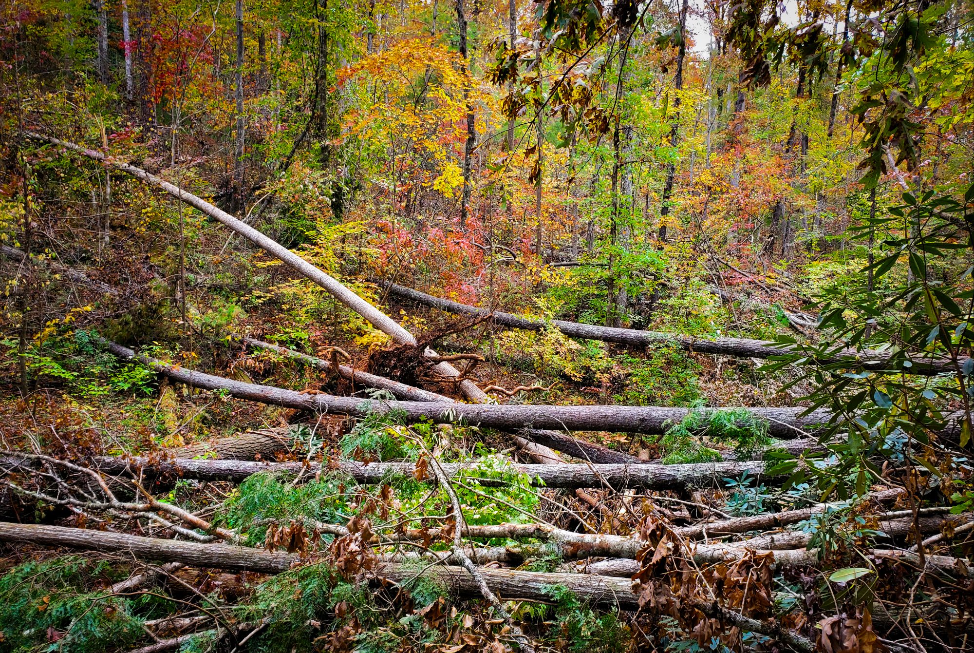
The rain that fell into the highlands of Mitchell County NC and Yancey County, North Carolina converged into cauldrons around high mountain streams which began bursting and flowing downward through the hollars, creeks and bubbling streams, funneling into a torrent of deadly water 30 – 50 feet high as it washed through small towns, family settlements and down the beautiful pristine mountain forest hillsides. The rain caravined downhill through long scenic valleys creating over 600 deadly avalanches of giant trees, mud, debris and water.
The crashing torrent swept away businesses and homes with entire families who had gathered and were riding out hurricane Helene together. Hundreds died, including one of the front desk employees at the Little Switzerland Inn where we are being graciously housed. Over 200,000 families have applied to FEMA for financial assistance. This horrific flood event was the worst in Carolina history. The previous record was set in 1791, the amount of water flow here surpassed it by inches.
I hope I’ve painted a picture that remains with you forever, this is the most complete, complex and destructive natural disaster our organization has seen since hurricane Katrina. The work to be done will take decades… unless, you take action now. The more people that roll up their sleeves and help the faster these beautiful communities recover. So, we encourage you to show up, help us cleanup and donate. ~Rob
-‘We are using your funds for direct cash giving to individuals. -Supply purchases. -To ensure team members can remain and help for long periods of time. -To secure equipment needed to work on properties. -To cover fuel, meal and living expenses.
Show up, we have housing and will feed you – Volunteer.GoCajunNavy.org. Choose Ground Force Humanitarian Aid as your team when you register.
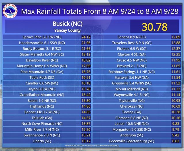
Here are the official rainfall amounts from the National Weather Service.
– 1. Busick in Yancey County had the most recorded rain in the period of time at 30.78 inches. – 2. At 24.12 inches Spruce Pine in Mitchell County came in second. Hendersonville: 21.96 inches Mountain Home: 17.09 inches Candler: 16.18 inches Tryon: 15.78 inches Grandfather Mountain: 15.42 inches Highlands: 14.86 inches Banner Elk: 14.85 inches Mills River: 13.26 inches Swannanoa: 13.21 inches
So I went down to the River Arts District yesterday in AVL, on my way home from Spruce Pine.
Jesus Christ.
Yes I did take photos and I’m not even sure I should post them tbh. It IS that bad. And there are people sleeping in tents out there by the river last night.
Asheville, I love you all so much. Your music, your art, your culture, your beauty, but especially your people. I am so sorry. It’s gonna be amazing when you rebuild.
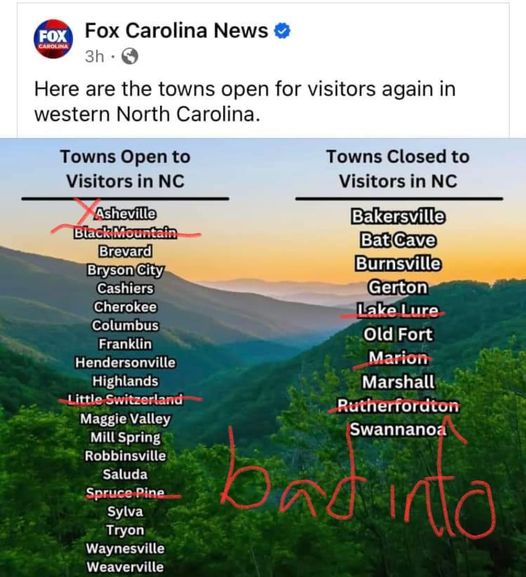
Fox Carolina News got it pretty wrong here unfortunately. I’ve been to a lot of these locations in the past few days. Let’s talk about them.
Asheville – WAVL is coming back, businesses are re-opening, they could definitely use some income to help their surrounding community. But you saw what I said this morning about the River Arts District. Biltmore Village is also decimated.
Black Mountain – sits immediately next to Swannanoa and took some of the very worst damage from the storm. The army was at the FEMA camp in the Ingles parking lot helping distribute supplies on Friday.
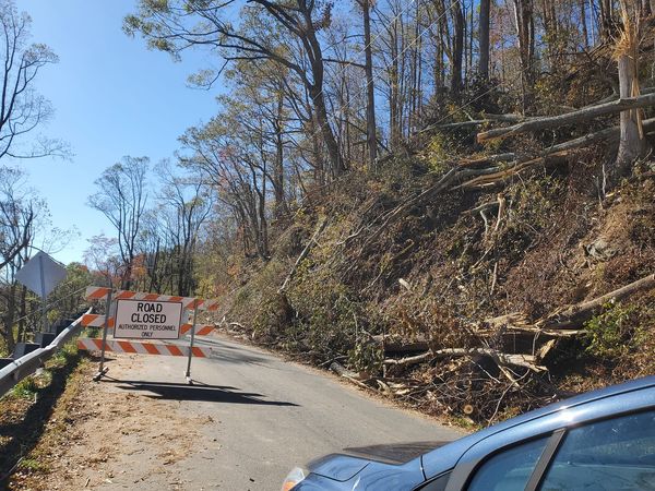
Little Switzerland – Hwy 226 is CLOSED past Spruce Pine and is extremely dangerous to try to access. Utility crews need to be able to access and fix the power lines, and I’m concerned the road will crumble further under all those out-of-state vehicles I saw driving right past the supply distribution site I was at, towards the Blue Ridge Parkway. If the roads fall apart any more it WILL re-isolate communities and cause massive issues. STOP DRIVING THROUGH ROADBLOCKS!
Spruce Pine – I passed by the tourist attractions myself. They were not open. The Skyline Village Inn is being used as a supply distribution site. The army was showing up as I was leaving. I was still driving over downed power lines. You can access via Hwy 19, but for the time being, they do not seem ready for tourism again.
Lake Lure – things are improving, businesses are slowly opening back up, yes it’s true. But I’m still hearing that you will probably have to pull over somewhere and hike up that way. Remember, the whole town exists along one tiny, windy cliffside road. The speed of rebuilding in Lake Lure and Chimney Rock has been absolutely incredible.
Marion – been back open for business for a few weeks actually. McDowell County did get hit super hard, and 221 is still not clear from the north, but I-40 and hwy 221 are both clear routes to access downtown and support some local businesses to help give the rest of the county some tax income.
Rutherfordton – also been open for a few weeks now; they’re closer to SC on hwy 221, so they had the road cleared maybe a week before Marion.
–
Please let me know if there’s any dispute or update. I haven’t seen FOX or any other journalists at all in WNC, so really listen to the locals if you wanna know what’s going on anywhere. Drive safe – seriously, the most dangerous thing in WNC right now might be the traffic from outsiders. If the traffic light is out, treat it as a four way stop sign. Thanks ya’ll
After a lot of thought and talking to some folks, I have decided to post the photos that I took Sunday evening at the River Arts District in Asheville. Posting unedited, raw photos since folks in the Appalachian Americans group falsely accused me of posting AI images the other day. I saved the worst ones for the end.
At the end, I posted some photos I took last year in a nearby area – not the exact same location, but I wasn’t able to walk very far without being blocked by debris and mud. Just so ya’ll know how beautiful this place will be again one day.
There were people sleeping in tents. There were people searching up and down the river for bodies. And there were people walking their dogs and playing Frisbee. It is surreal. I sat on that couch by the river for a bit. Around the corner on Haywood Road, businesses are starting to re-open and still helping their city in any way they possibly can. In the other direction at Biltmore Village, there is a lot more cleanup that still needs to take place.
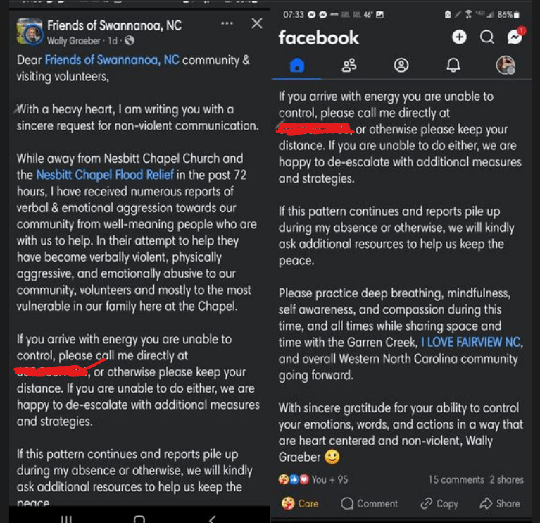
Screenshotting this here because FB will not even allow me to share posts from a group right now, apparently. Wally Graeber – thank you and please let me know if I should edit or take this down.
I want to add something: this is FAR from the first time I have heard about physical aggression and threats towards locals or volunteers, from folks coming into the area. I have also seen (and been on the receiving end) of a lot of nasty comments from those who feel entitled to say whatever they want, or hold assistance over people’s heads until they get the response they’re looking for. I have NOT experienced ANY of this from local communities themselves.
Wally has patience and compassion I should aspire to. These folks have been through enough.
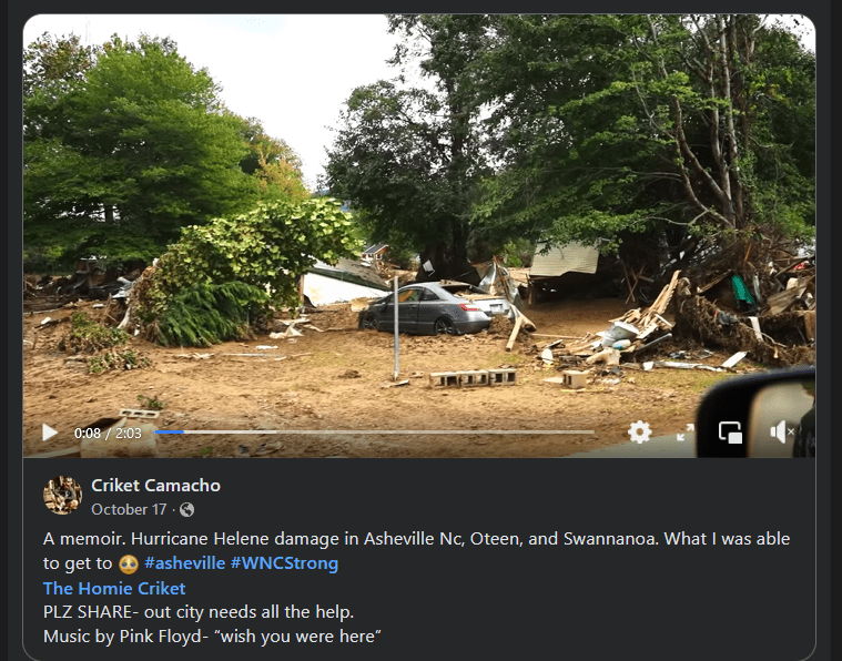
This is the one that hurts me the most – because this is where I live. This is the magical place I’ve shared photos of so many times, walking through the trees where the barred owls call for each other and art pops up in the most seemingly random places. I haven’t shared the photos of poles down on the roads or the massive trees on my neighbors’ homes or the businesses that will never re-open.
It could have been so, so, so, so much worse if the Lake Lure dam had failed. I wouldn’t have a home and I don’t think I would even have a neighborhood right now. There’s a whole lot of “That could have been me” running through my head in the last few weeks.
Ya’ll please pray for Spartanburg too I fell in love with this city and made it my home because the people here are the strongest and hardest working I have ever known. And these photos, taken by me 3 weeks after the storm, will show you how much effort has gone into cleaning up this Greenway. I was not involved in any of it. God bless this Burg. I love you all so much. And we will ALWAYS stand with our northern neighbors.
Part 2 coming in a little bit due to the number of photos. Luckily, no ripped up RVs or destroyed buildings this time. We’ll be okay.
The videos and photos at the very end were taken hours after the storm hit. The rest were taken on Saturday, October 19. All by me.
I could have told you the names of every single plant and tree along this stretch of Lawson’s Fork Creek. Sometimes I picked the blackberries for food when I didn’t have much money, or foraged passionflowers and vervain for tea…
Appalachia strong look how much volunteers have already done to clear the path forward. So we WILL keep moving forward.
Remember when I was targeted in late August/early September by a network of fake profiles and bots on every political meme that got attention? After a few weeks, it stopped as suddenly as it started? Facebook’s own quarterly Threat Analysis reports have really interesting things to say about disinformation networks – they call it CIB (Coordinated Inauthentic Behavior)
I’m seeing entirely different tactics this time around, but I’m seeing similarities as well. Lots of folks showing up in the same public forums, coming from groups they refuse to publicly name; acting the same way, using the same language; claiming to be people they are not – all in order to derail public discussions for political reasons, and make people believe there are a lot more of them than there really are.
This was what I posted after I lost my job.
As a contractor, you get used to it.
I turned down the next contract I was offered in order to keep supporting the recovery in Appalachia.
There are a ton of folks right now reaching out to reunite their neighbors with family photos, quilts, urns, Bibles, even pets – and people. Or trying to get RVs and generators to those who need them most. It’s pretty amazing to witness.
So I have a theory now about why my account keeps being restricted –
I’ve been reporting A LOT of spam and bot accounts. You’ve seen my posts, you’ve seen the comments and fake profiles all over the place. In some cases I’ve even gotten in touch with real people whose profiles were being spoofed.
Meta’s own AI does not appear to be capable of distinguishing bots from real profiles, or spam from genuine comments. I just went through my support inbox – NOT ONE SINGLE PROFILE OR POST was taken down. That’s pretty shocking. This includes hiring scams to get people’s personal info, fake profiles to swindle unsuspecting users, and bad info that could put WNC hurricane survivors in serious jeopardy. Some of it is extremely obvious. Also, REAL threats of violence, disturbing content, and dangerous conspiracy theories are being ignored. Some of these were reported to real organizations and authorities who took them very seriously, but Meta is leaving them up.
The more Meta cuts their human staff and relies on bots to police bots, the worse things get on this platform. And with all of my “unsubstantiated” reports piling up, I suspect the AI is now putting restrictions on me that don’t make any sense. They also keep being renewed, instead of expiring like they are supposed to. It is preventing me from commenting directly on scam posts to warn others, or sharing good intel from groups and pages – and at this point, I can’t always even respond to comments on my own posts. It seems to change hour by hour. In 14 years on this platform I have NEVER experienced moderation this bad and inconsistent.
It’s not about my profile, it’s about what Facebook is allowing to perpetuate while they continue to cut corners and eliminate human staff in favor of the doomed AI projects they keep pushing out – just weeks before Election Day when scams and false rumors are causing more harm than I’ve ever seen before.
If they can’t get it together, when all is said and done up in the mountains, I will finally be done with Facebook once and for all. They need to suck it up, take some of those billions they are wasting every financial quarter on “virtual reality,” and put it towards human reality – eyeballs and brain cells that can distinguish between fact and science fiction where AI cannot. Hell, they could hire people from WNC on a temp basis, I know folks need it. (Unlike those fake links about Pepsi now hiring that Meta refuses to take down.)
In hindsight, I don’t know if this theory had any truth to it or not. However, the restrictions on my profile didn’t go away until after I stopped reporting scams, bots, harassment, and the like.
And not one of them ever apparently resulted in a removal, so how I ended up being censored instead is… still a question I wish I could ever get an answer to. But of course I won’t.
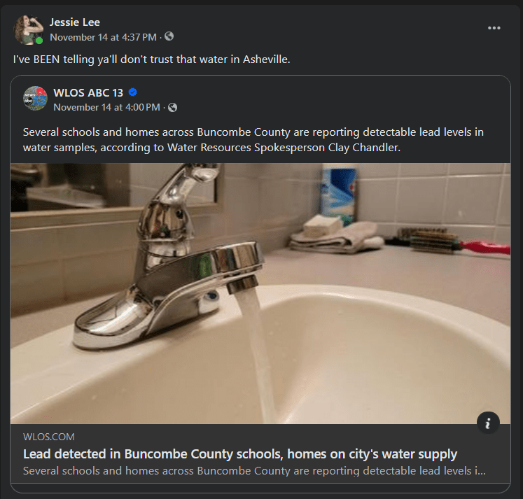
This was posted in a Spruce Pine FB group. And when I got some dirt on my arm for just a moment in Spruce Pine (picking up a box that had been on the ground), I washed it off with hand sanitizer, but that was not enough to prevent a rash. I’ve also gotten blisters from the flood mud before. PLEASE take this seriously.
Note: some agencies/orgs right now are testing for biological contamination, but NOT chemical contamination. Be mindful of that.
I went to Lake Lure and Chimney Rock today… and I was SHOCKED at what I found!!
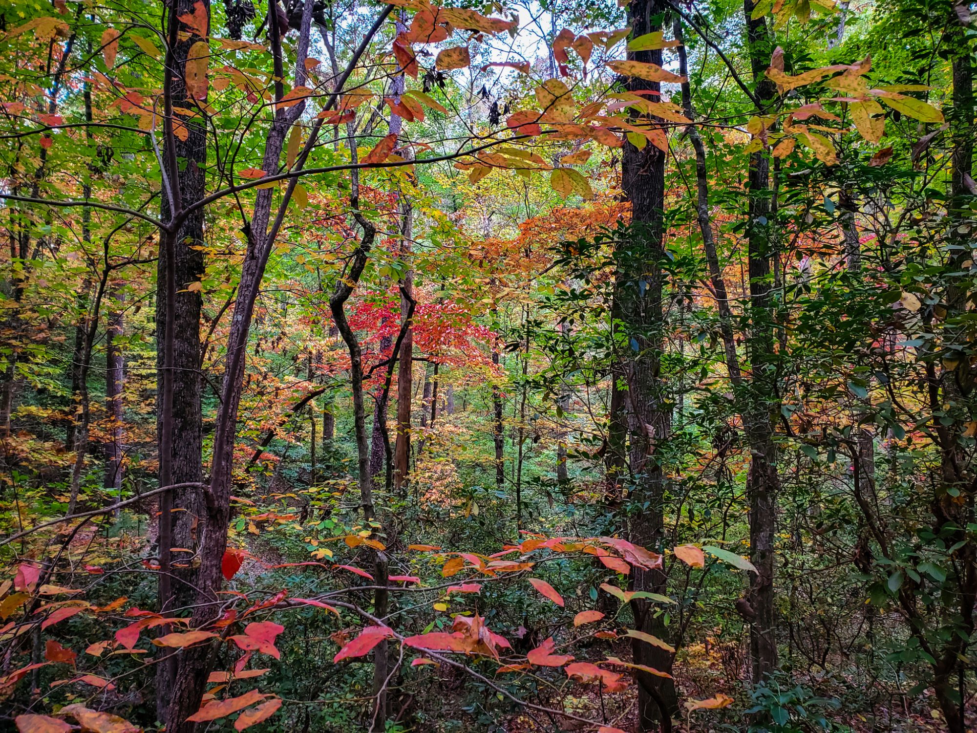
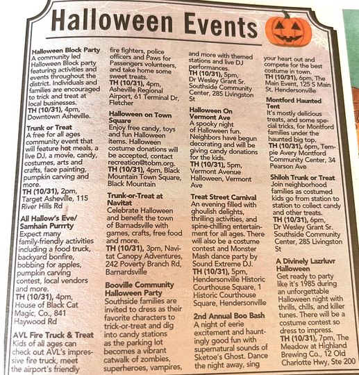
It’s beautiful! The roads are accessible! I drove straight in from Highway 9! There’s live music and celebration! Halloween costumes, kids playing, live music, homemade sweets being offered for donations. And oh God, the mountains are so beautiful right now, the fall colors are peaking, nature is sloooowly healing from the damage.
There is still a lot of rebuilding to be done…
But it IS happening.
God is real good. And a lot of real good things are happening in the Hickory Nut Gorge to wash away the pain and the loss.
Celebrate tonight. Sing, dance, be glad to be here. We’re glad you are.
P.S. just to be clear – Chimney Rock is still NOT accessible unless you are local or with an organized aid group. And that is how the community wants and needs it to be right now while they focus on rebuilding – and oh yes, they are doing an incredible job of rebuilding. Keep to safe, accessible roads! You’ll be able to see and enjoy plenty.
Every person is dealing with things in their own way.
I’ve never seen the local businesses so full, even in areas where the power has been restored for most people. We’re all seeking out some sense of normality again. We’re searching crowds for the faces we used to take for granted.
Some of the things I heard on the street last night:
“Yeah, we’re good, we’re good…”
“We have SO MUCH right now…”
“I was just worried about everyone else here…”
“Oh – is that my order? I was just…”
“Well it’s all around us, but we were alright where we’re at…”
–
When you come, please be respectful. Be patient. Be kind. Keep to safe roads. People are going to be wrestling with the trauma of this horrible situation for a very long time. You’ll speak with one person distracting themself and trying not to cry, another one losing their temper, another one who’s sweet and smiling with their favorite earrings on. Whatever you think is important from a customer service perspective – just reconsider from their own perspective. Remember when you’ve gotten through a work shift on a bad day just to take your mind off of things. That’s every day right now for a lot of people, including business owners.
If you’re not quite there yet, I’d highly recommend finding a place to bring donations or to volunteer for a few hours before making your way to the local open businesses. Put it this way – you’ll appreciate every other experience a heck of a lot more after you see things for yourself.
P.S. Hwy 176 is open up to Tryon, but has some flood mud parts around Campobello to watch out for. The farmland down that way got hit hard by Motlow Creek flooding. New Cut Road is partially washed out by flooding. 176 is NOT open where it turns towards the Saluda Gorge, and may be closed through January (a lot of people live down there by the way!) I’m seeing as of this morning that Saluda itself is accessible again from I26. Can’t wait to take my favorite drive in the world again when it opens back up.
P.P.S. There are photographers who have done crucial work to document the devastation of the storm and its aftermath. Those photos are so crucially important for us to understand what happened here. I have chosen to take photos that show recovery and life. That’s my decision, that’s my contribution.
I live in Spartanburg, SC, 12 miles from the NC state line, which is also an affected disaster zone.
Yes, this is the foothills of Appalachia, also called the Upstate. No, Spartanburg is not in the Lowcountry.
Yes, we got hit by Helene – actually we took the vortex immediately before it hit the mountains. Yes, there is widespread tornado and flood damage even in my neighborhood.
I have crossed into WNC and back 5 times since the storm and made 3 successful supply runs. I don’t have any special pass. I just use Google Maps to check road closures and try not to act stupid.
There are two URGENT needs for volunteers in the mountains right now:
1. Folks to sort donations at supply distribution sites. (Especially if they are temporarily pausing donations because they are full and trying to sort what they have.)
2. Folks to assist with constructing emergency shelter in the worst affected areas. (Swannanoa, Black Mountain, Avery County, Yancey County, Mitchell County, Watauga County, Ashe County)
If you are bringing children with you, please strongly consider #1, and consider what “worst affected” means here.
If you are a licensed contractor, or have the necessary experience and tools, please consider #2.
There is also a CRITICAL need for RVs, generators, portable toilets, and tent insulation in Swannanoa and throughout the rural High Country at this time.
Please keep yourselves safe and avoid scammers when you come out to an unfamiliar region to volunteer. Every request for assistance should be accompanied by all relevant information:
WHO are you dealing with?
WHAT is your role?
WHEN is it happening?
WHERE is it happening?
HOW are you getting there?
Be wary of anyone who asks for your support, but refuses to provide this information except under certain conditions.
You have to consider your own safety as well. Secure your own oxygen mask before helping others.
I hope this poem brings someone comfort today who is dealing with grief and survivor’s guilt. You’re not alone. Let yourself feel all of the emotions.
This land is well familiar with tragedy and hardship throughout history, and that’s why strength is in their blood and steel in their spines.
I took this photo at the Saluda Train Depot Museum. I don’t know the name of the author.
The town has been badly affected by the storm; please consider visiting and supporting their downtown just off I26 if you are passing through WNC. Drive safe!
Once again I’m hearing nonsense about checkpoints at the “border to WNC” and such… do ya’ll just need directions?
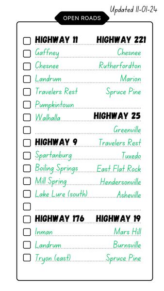
These are road conditions as of tonight, as I have personally witnessed and driven. Let me know if there are any updates:
**UPDATE 10/19 @ 22:47 – Hwy 80 is NOT CLEAR.
** UPDATE 10/22 @ 4:41 – I-26 and I-85 are CLEAR BUT DANGEROUS due to traffic in/out of WNC some of ya’ll have absolutely no business pulling a trailer.
** I-40 is CLEARED as far west as Maggie Valley, and nobody can really say when the portion at the TN border will be driveable again.
** UPDATE 10/22 @ 4:41 – Hwy 19 is CLEAR to Spruce Pine, but recommend to keep to inside lanes, especially with large vehicles. Watch for roadwork.
** Hwy 70 is being RE-CLOSED in some areas where it was re-opened; similar situation as 19 I-40 is your best bet.
** UPDATE 10/22 @ 4:41 – Hwy 226 is NOT CLEAR this road risks further damage if people keep bypassing the roadblocks.
** Hwy 74 is CLEAR , 74A is NOT , 64 is NOT [update 10/21 @ 4:41 – 74A is clear to Green Hill only]
** Hwy 18 is CLEAR.
** UPDATE 10/22 @ 4:41 – Hwy 221 is CLEAR to Marion but dangerous past that point; 221A is CLEAR.
** Cut-through roads between Hwy 221 and Hwy 74 in Rutherford County have flood mud. Drive with windows up and watch for trees if it gets windy. Highly recommended to stay on major highways anywhere further west than Cherryville, NC.
**Hwy 29 has recently been CLEARED of tornado damage in West Cowpens all the way thru to Zion Hill, and in East Spartanburg. I do not advise this portion of the hwy in dark or windy conditions. (FEMA crews only fixed us up enough to stabilize and access the mountains from here.)
** Hwy 296 is CLEAR.
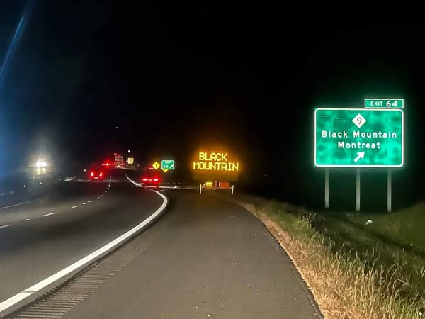
** UPDATE 10/22 @ 4:41 – Hwy 9 HAS BEEN CLEARED!!! totally exceeded my expectations!
** Hwy 11 is CLEAR, but near Campobello includes areas of flood mud. Drive with windows up and watch for road closures on nearby roads due to washouts.
** New Cut Rd is NOT CLEAR recommend finding a different route and avoiding flood mud.
** Hwy 176 is ONLY CLEAR as far north as Tryon. Saluda Gorge will be inaccessible until February. I-26 is your best bet.
** Hwy 101 has been CLEARED of tornado damage in Greer.
** Hwy 25 has been CLEARED of damage.
** Hwy 276 is NOT CLEARED.
–
Never drive through a roadblock.
Do you understand how bad landslides are for mountain roads? If you need to be rescued, you are taking away critical emergency services from the community you’re trying to help. If you damage or block a newly re-opened road, you are only hindering relief efforts.
–
And yes… resources were making their way back up to the mountains this morning. Convoys of utility trucks, line trucks with cabling, trucks with DISASTER RELIEF printed on them, trucks hauling every type of equipment you can think of, trucks trucks trucks trucks trucks.
You gotta understand how much stress that much heavy vehicle traffic puts on smaller roads.
Stay safe on the roads and ya’ll have a good weekend
I just came from dropping supplies at Ingles in Black Mountain. There’s a big FEMA sign along the road when you pull in. 101st Airborne Division (Air Assault) helped me unload cases of water and other supplies – they were all very nice. Donations are set up in shopping carts in the parking lot. They did not need my reusable grocery bags and they don’t think they’ll need containers in the next few days, but they did accept the water, clothes, gloves, boxes of tea, a set of crutches, and an empty diesel fuel cannister. The bags and containers will end up going to a smaller distribution point.
I drove along I-40 with the sun setting behind me, along the Swannanoa River, through the Pisgah Forest, past Old Fort and Marion. It is so beautiful. It is so devastated. The land bears fresh scars, the cars are coated top to bottom with mud, half of the trucks bear signs that say DISASTER RELIEF or HURRICANE RELIEF. I passed an American flag flying on a fallen tree. I passed by more military vehicles. I passed by utility convoys. Hwy 321 was clear. I-85 is a nightmare.
I’m here at Tommy’s Pub in Charlotte now for a benefit show through JonAlex Richard and I will be bringing more supplies up this weekend. Every single supply run has included donations from multiple folks. This is such a group effort, everywhere, everyone, whether they can physically make it up to the mountains or are supporting from a distance.
Honored to be here tonight. It’s been way too long. Stacy Badger is holding it down tonight and Charlotte already knows she’s the best bartender.
The psychological whiplash of going directly from dealing with soldiers at the disaster zone in Black Mountain, to a punk show two hours away in Charlotte, was something I cannot describe in words.
To be literally dancing on the edge of disaster…
The bands raised several hundred dollars that night that I was able to put towards warm baby clothes, toiletries, and food items that I brought to Spruce Pine, NC. A lot of churchgoing folk up in the mountains have been absolutely tickled to hear that the punks in Charlotte were doing God’s work on their behalf.